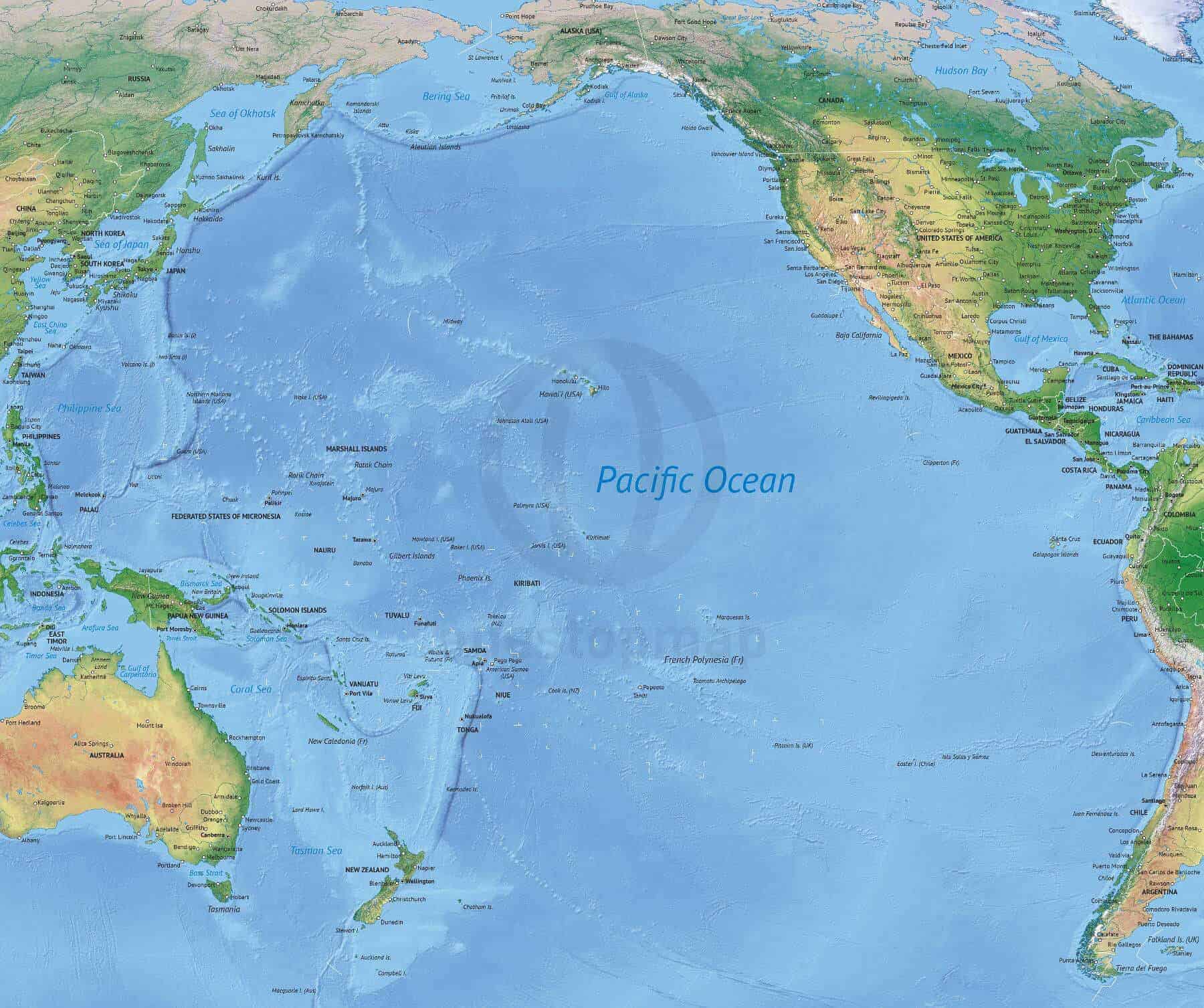
Click or tap the preview to enlarge it. Use the zoom button to inspect map details.
Political map of the Pacific Ocean with countries, states and provinces, capitals, major cities, rivers and lakes over an image-based shaded relief background.
Digital download. No printed map is shipped. Choose your edition below.
License depends on your edition. Premium editions include our royalty-free license for personal and commercial projects. Attribution Required editions use CC BY and require credit to One Stop Map. Resale and file sharing have specific conditions.
| Dimension JPEG | 20 in (50.8 cm) wide – 300 dpi |
|---|---|
| Dimension Vector | 21 x 18 in (54 x 46 cm) – scalable to any size you want |
| Layers | City point, Coastline, Country area, Country boundary line, Grid, Lake, Legend, Name capital, Name city, Name country, Name ocean-sea, River, Sea area, Shaded relief (image), State-province area, State-province boundary line |
| License | Royalty-Free |
| Map Style | Summit |
| Map Projection | Robinson |
This Summit-style map combines countries, states and provinces with a shaded relief background. Its Robinson projection gives you a regional overview of the Pacific, with capitals, major cities, rivers and lakes to provide context around the ocean.
Use it as a base for a Pacific-focused presentation, educational handout or editorial illustration. The Print edition is suitable when you want to use the supplied design. Choose Print & Edit when you need to adapt colours, labels or the visible map layers to your project.
The layer list includes country and state/province areas and boundary lines, city points, capital and city names, coastlines, rivers, lakes, ocean and sea names, a grid and a legend. The vector document is 21 × 18 inches; check the preview for the exact coverage and level of detail.
The shaded relief is an image background. Map features and labels are organised in vector layers; the relief itself is not editable vector artwork.
Compare printable and editable maps before selecting an edition.
For a world overview with Asia and Australia at the centre, see our Robinson world map with shaded relief. For detailed continental coverage, compare the North America map with shaded relief.
Premium editions include our royalty-free licence for personal and commercial projects. Resale, file sharing and use by multiple people have specific conditions. Contact us if you need an extended licence or help choosing an edition.


Kaipo Manoa (verified owner) –
Thank you for having an awesome map available of my Pacific island home. The map does show the Polynesian migration out of SE Asia, Taiwan, following the austronesian people. But there were other austronesian people that went west to Malaysia as well. For education purposes it would be great to show that distance from Malaysia to Easter Island (Rapanui). The website is easy to navigate with just a few clicks. Quick response and support availability helps put me at ease knowing that I can trust the transaction.