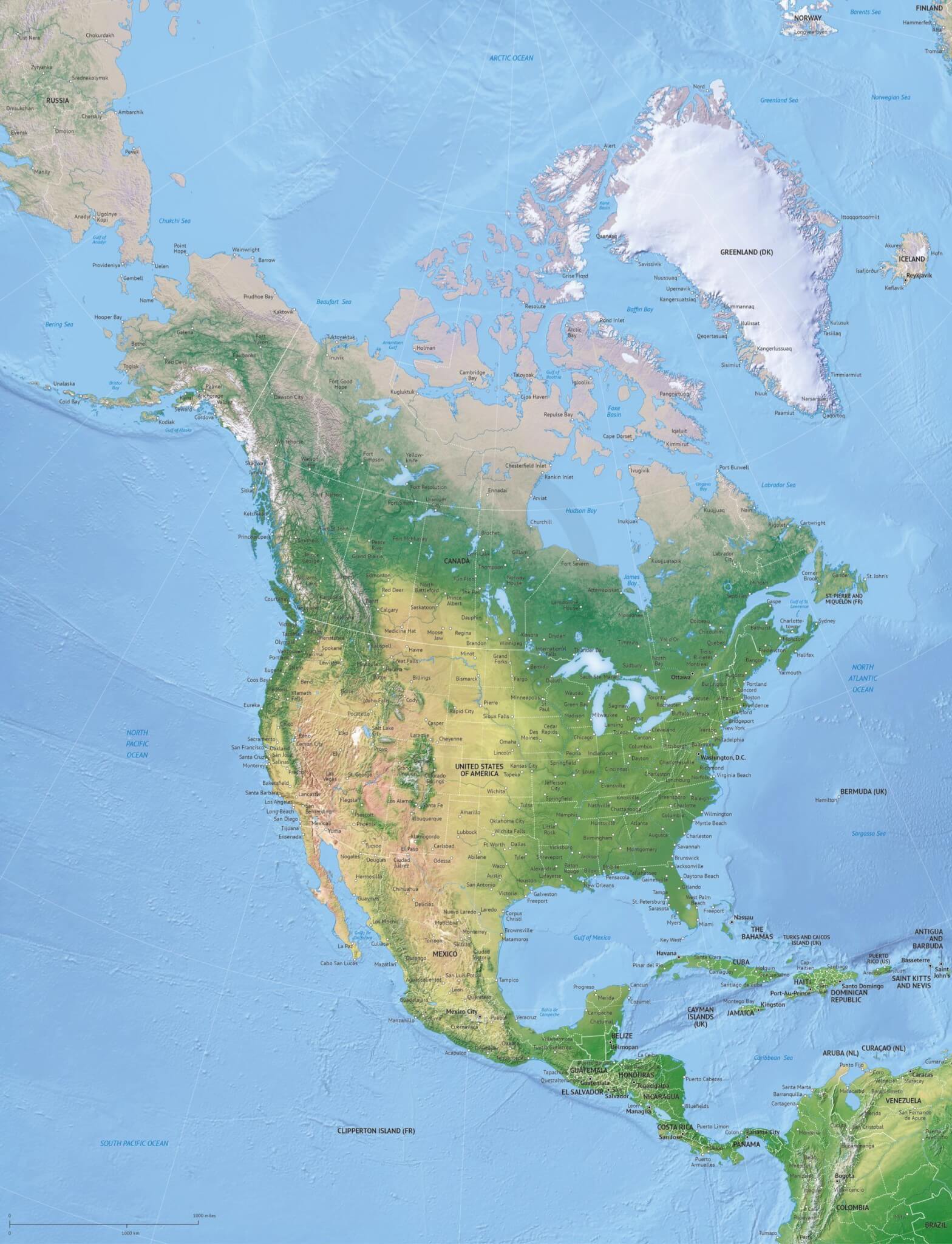
Click or tap the preview to enlarge it. Use the zoom button to inspect map details.
Detailed political map of North America with shaded relief, countries, states and provinces, capitals, major cities, rivers and lakes. Choose Print for a ready-to-use map, or Print & Edit for layered AI and PDF files. In the editable version, country and state areas can be selected and styled separately. View the commercial licence.
License depends on your edition. Premium editions include our royalty-free license for personal and commercial projects. Attribution Required editions use CC BY and require credit to One Stop Map. Resale and file sharing have specific conditions.
| Dimension JPEG | 20 in (50.8 cm) wide – 300 dpi |
|---|---|
| Dimension Vector | 17 x 22 in (42 x 55 cm) – scalable to any size you want |
| Layers | City point, Coastline, Country area, Country boundary line, Grid, Lake, Legend, Name capital, Name city, Name country, Name ocean-sea, River, Sea area, Shaded relief (image), State-province area, State-province boundary line |
| License | Royalty-Free |
| Map Style | Summit |
| Map Projection |
This Summit-style political map combines a shaded relief background with countries, states and provinces. Capitals, major cities, rivers and lakes add the geographic detail needed for a continental reference map.
The 17 × 22 inch vector document provides a portrait layout for reports, presentations and educational material. Use the supplied design as a finished map, or choose the editable edition to adapt the information shown for your audience.
Country and state/province areas and boundary lines are organised alongside city points, labels, coastlines, rivers, lakes, a grid and a legend. The relief background adds terrain context, while the vector layers let you work with the map features in compatible software.
The shaded relief is an image background. Map features and labels are organised in vector layers; the relief itself is not editable vector artwork.
Compare printable and editable maps before selecting an edition.
Compare this map with the Naturalist physical map of North America if elevation and physical features are your main focus. For ocean depth bands in a political map, choose the North America map with bathymetry.
Premium editions include our royalty-free licence for personal and commercial projects. Resale, file sharing and use by multiple people have specific conditions. Contact us if you need an extended licence or help choosing an edition.




Reviews
There are no reviews yet.