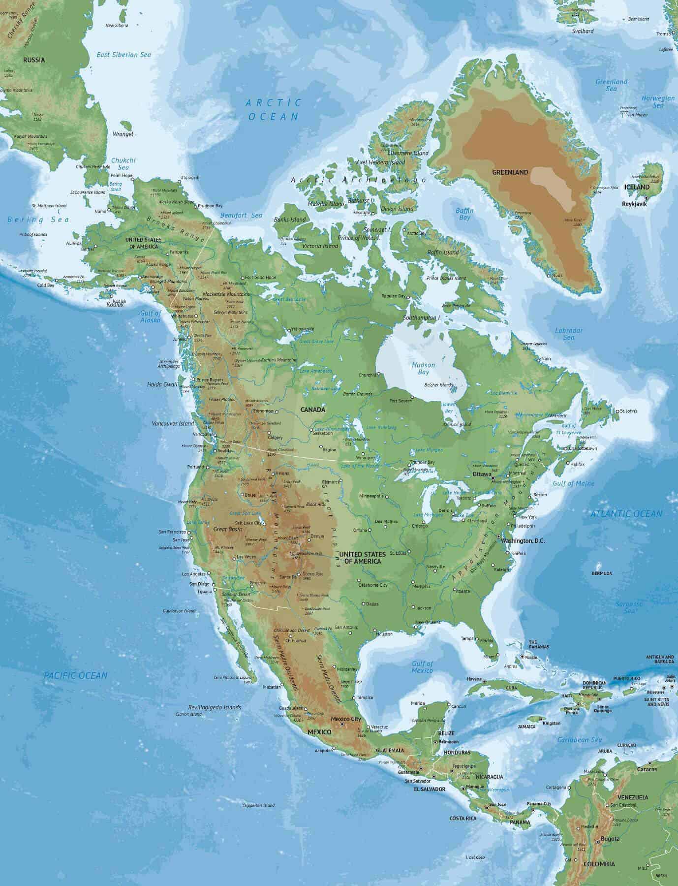
Click or tap the preview to enlarge it. Use the zoom button to inspect map details.
A physical map of North America in Naturalist style, showing elevations, bathymetry and named physical features alongside countries and cities. Uses a Lambert Conformal Conic projection. Choose Print for a finished map or Print & Edit for layered AI, EPS and PDF files.
License depends on your edition. Premium editions include our royalty-free license for personal and commercial projects. Attribution Required editions use CC BY and require credit to One Stop Map. Resale and file sharing have specific conditions.
| Dimension JPEG | 20 in (50.8 cm) wide – 300 dpi |
|---|---|
| Dimension Vector | 16 x 12 in (40 x 32 cm) – scalable to any size you want |
| Layers | Bathymetry, City point, Coastline, Country area, Country boundary line, Elevations, Frame, Grid, Lake, Legend, Name city, Name country, Name physical, River, Sea area |
| License | Royalty-Free |
| Map Style | Naturalist |
| Map Projection | Lambert Conformal Conic |
This map brings together elevation, bathymetry and physical-feature names with country boundaries and cities. Its Lambert Conformal Conic projection and 16 × 12 inch vector document provide a landscape layout for exploring North America’s physical geography.
Use the map in a presentation, educational worksheet or report that needs terrain and geographic context. Political information remains available alongside the physical features, so you can orient the reader using countries and cities.
The product’s layer list includes elevations, bathymetry, physical-feature names, countries, city points and names, coastlines, rivers, lakes, a grid, a frame and a legend. Check the preview to assess which features are labelled and how they appear at your intended size.
Compare printable and editable maps before selecting an edition.
For a political map with an image-based relief background, see the Summit North America map with shaded relief. The Lucid North America map with bathymetry combines political detail with separate ocean-depth bands.
Premium editions include our royalty-free licence for personal and commercial projects. Resale, file sharing and use by multiple people have specific conditions. Contact us if you need an extended licence or help choosing an edition.




Reviews
There are no reviews yet.