To change a map’s colours in Adobe Illustrator, open its layered vector file, select the geographic area’s artwork and change its fill. Keep boundaries, water and labels on their own layers. A JPEG is one finished picture, so its individual states cannot be selected this way.
We tested the steps below with the AI file from our California Defined map in Adobe Illustrator 2026, version 30.8.2, on macOS. The example changes the state areas to warm sand, then highlights California in terracotta.
Download the vector edition and extract the ZIP. Open the .ai file, then save a working copy before editing. This example contains 14 top-level layers. Other products can use different layer names or structures, so check the file rather than assuming every map is identical.
Open the Layers panel from the Window menu. In our test file, the filled state shapes are in State area. Separate layers contain the boundaries, rivers, lakes, city points and place names.
Highlighting a layer’s name is not enough: it makes the layer active but does not necessarily select its paths. Use the selection column at the far right of the State area row to select that layer’s artwork. Check that the intended shapes show selection outlines.
Choose the fill control, rather than the stroke control, and enter a colour. We used warm sand #e7dfcf for the state areas, keeping blue for water. Because the boundary lines and labels are separate, this selection lets you recolour land without selecting those objects.
Expand State area to see its objects. In this file they have useful names, including California, Nevada, Oregon and Arizona. Deselect the previous selection, then select the artwork for California in the layer’s selection column.
Change its fill to your highlight colour. We used #c66b45. Check a neighbouring state before saving: if every state changed again, the whole layer’s artwork was still selected. Undo, deselect and select only the California object.
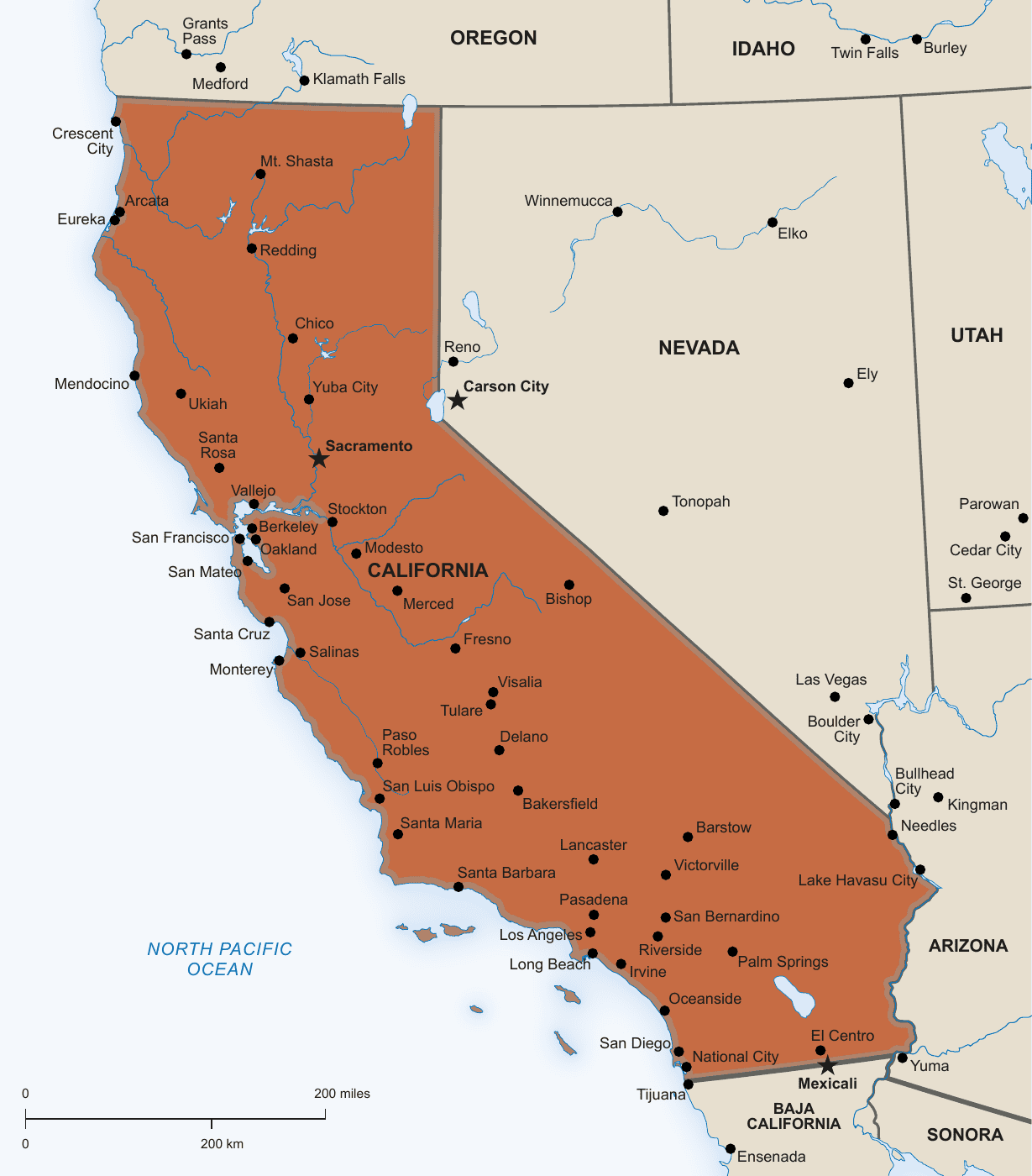
Zoom out to the size readers will see. Check that names remain legible and that the highlight still stands out. Colour alone may be insufficient for some readers, so identify the highlighted place in your caption or surrounding text as well.
Keep the editable AI copy, then export the image needed for your website or slides. For print, agree the PDF settings with your printer. A legacy-format warning on saving deserves attention: keep your original download and avoid overwriting it while testing.
Check that the layer is visible and unlocked, that artwork is selected, and that you are changing its fill. A selected boundary line uses a stroke; a JPEG has no individual state paths. See our map layers guide and file-format comparison if you are unsure what you opened.
Try the free Attribution Required edition of California Defined. If you use the adapted map, credit One Stop Map and indicate your changes as explained in our free-map licence guide.