Click or tap the preview to enlarge it. Use the zoom button to inspect map details.
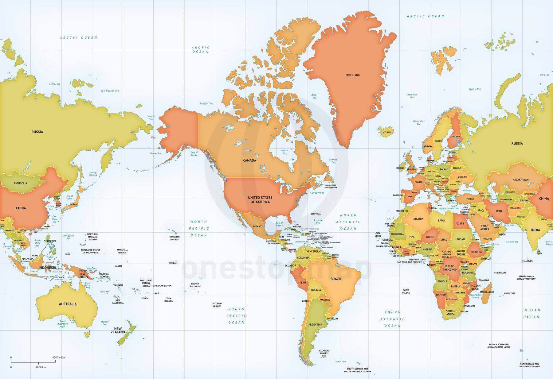
America-centered political world map in the Mercator projection, with country names, lakes, a grid and physical features. Choose Print for JPEG and non-layered PDF, or Print & Edit for layered AI, EPS and PDF vectors. This is a digital download.
License depends on your edition. Premium editions include our royalty-free license for personal and commercial projects. Attribution Required editions use CC BY and require credit to One Stop Map. Resale and file sharing have specific conditions.
| Dimension JPEG | 20 in (50.8 cm) wide – 300 dpi |
|---|---|
| Dimension Vector | 17 x 12 in (43 x 30 cm) – scalable to any size you want |
| Layers | Coastline, Country area, Country boundary line, Grid, Lake, Legend, Map border, Name country, Name physical, Sea area |
| License | Royalty-Free |
| Map Style | Lucid |
| Map Projection | Mercator |
This political world map uses the Mercator projection and places the Americas in the centre of the layout. The Lucid-style artwork includes country areas and boundaries, country names, lakes, a grid and physical features. Its vector base format is 17 by 12 inches and can be scaled for your design.
An America-centered layout can suit a presentation or publication whose subject starts with the Americas and then looks across the world. Check the preview to see where the map edges fall. With the editable edition, you can adjust the existing colours and labels or hide layers to make room for your own annotations.
This is a digital download. The premium map licence explains how the supplied artwork may be used.
Browse the world map collection to compare this Mercator view with other map layouts and projections before choosing a file.
Map of World political high detail Mercator Europe-Africa centered
from $49.95
Map of World political shaded relief Winkel Tripel Asia-Australia centered
from $24.95
Map of World political high detail Miller Europe-Africa centered
from $49.95
Formal map of the World political high detail Robinson Europe-Africa centered
from $49.95

Reviews
There are no reviews yet.