Many years ago, on one of my trips to Paris, I visited the Jardins des Luxembourg when I stumbled upon a little brass plate set in the ground with the word “ARAGO” engraved in it. The next day, at the Louvre Pyramid, I found a second one. This intrigued me so when I got back home I started to look into it.
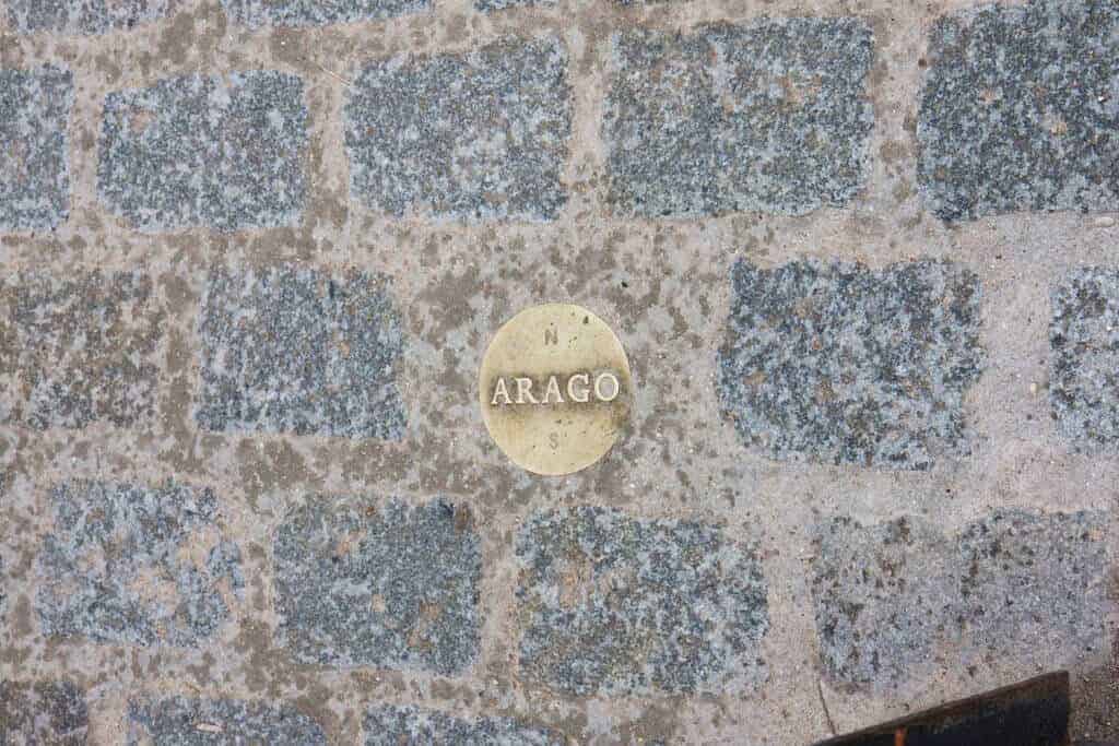
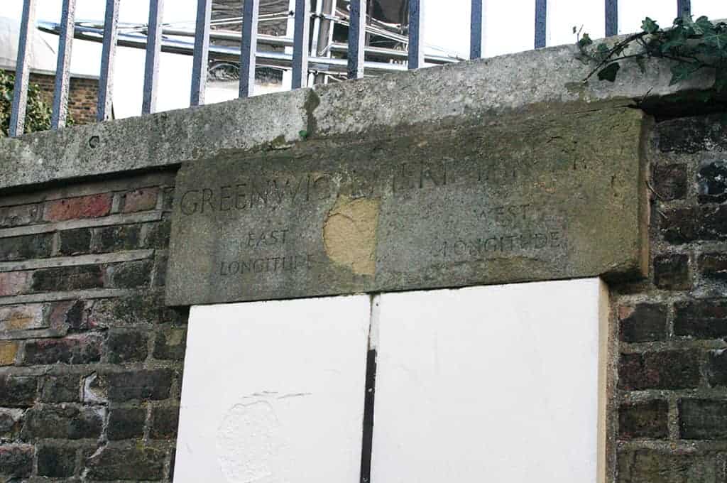
These markers indicate the Paris Meridian, which has been used by French cartographers in the 18th and 19th century and was recalculated by François Arago (hence his name on the markers). For a while it was a rival to the Greenwich Meridian that is now used as the “start point” for the longitudes around the world (which, incidentally, I have also visited)
This generally means that world maps are centered on Greenwich. Note the world “generally” because there are also world maps that center on other areas, most often North America or Australia/East Asia depending on their target audience. In fact, here at One Stop Map we sell a range of world maps centered at both of those.
This does cause a bit of a problem on the Europe-centered maps: if we pick 0 degrees longitude as the center of the map (the central meridian) the other side of the globe (the anti-meridian) runs through Wrangel Island, the far eastern part of Siberia and the island of Vanua Levu in Fiji before reaching Antarctica. This makes the map look odd with those landmasses appearing on the far left side of the map.
One possible solution is to extend the map on the right side so that the affected areas can be shown properly, another one is to center the map somewhere else to avoid the problem entirely (a third way that sometimes pops up is to simply omit those parts but that’s of course not an option).
So as of 2019 here at One Stop Map we will center all our new Europe-focused world maps on 11 degrees east longitude. Using this prime meridian, which is in the vincinity of Florence, Italy, means that the anti-meridian avoids most large landmasses. Not all unfortunately due to the Aleutian islands, which also end up on either side of the map this way. We feel it is a good compromise though.
And while we are on the subject of meridians, did you know that until the 19th century there were various different ones being used to mark zero degrees longitude? Besides the Greenwich and Paris meridians several European countries used their own and the United States used one in Washington (actually, four different ones in Washington).
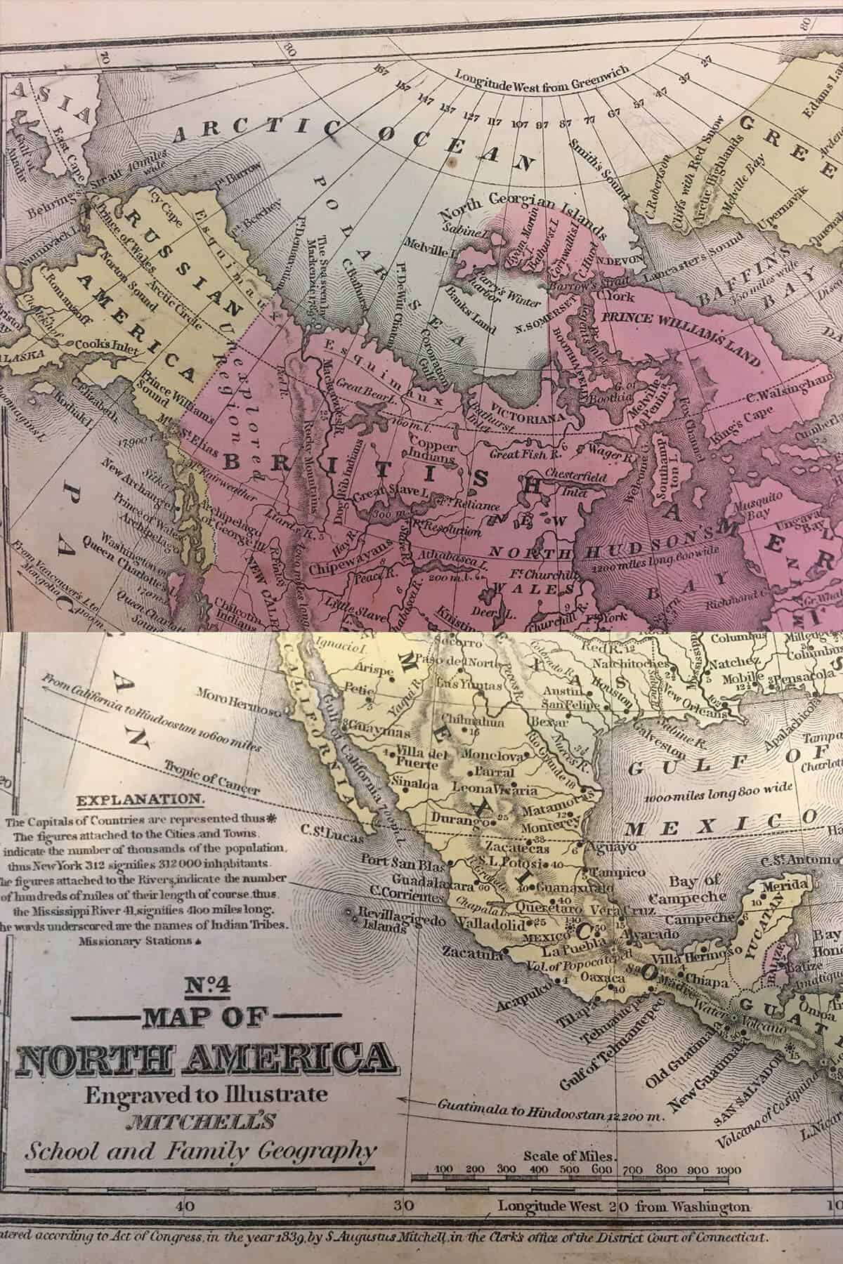
This map, from a 1856 US atlas, shows a longitudinal grid based on the Washington meridian along the bottom of the page but the longitudes in relation to Greenwich along the top, to aid conversion (also note the linework and the white, unexplored, areas in the Arctic, can you tell we love old maps?).
At the 1884 International Meridian Conference it was decided to globally adopt Greenwich as the prime meridian. Interestingly enough this wasn’t so much done for cartographic reasons but primarily for timekeeping which became a lot more important with the introduction of fast trains.