The right map projection depends on what your map needs to explain. Equal Earth preserves relative areas, Mercator preserves local angles, and Robinson and Winkel Tripel offer different compromises for a general world view. Every flat world map distorts something.
A projection is the mathematical transformation from the curved Earth to a flat surface. It does not determine which borders, place names or roads appear: those come from the map’s data and editorial choices. Changing a fill colour in Illustrator does not change the underlying projection.
No flat world map preserves all areas, angles and distances together. A compromise projection accepts distortion in several properties to provide a useful overall picture. Choose the trade-off for your subject rather than looking for one universally “accurate” map.
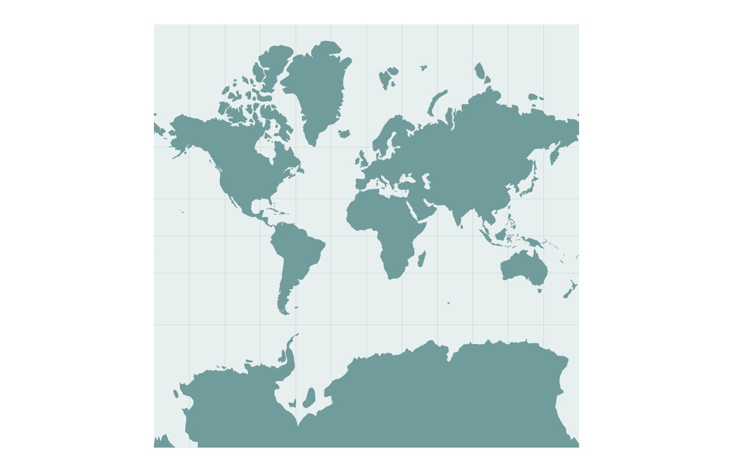
Mercator is conformal. A straight line represents a constant compass bearing, which helps explain its navigational role; that line is not generally the shortest route. Its growing scale towards the poles makes high-latitude land look much larger relative to equatorial land. It is consequently a poor choice for comparing the sizes of continents. See the PROJ description of Mercator.
For a lesson about relative land area, start with an equal-area projection. For a regional navigation-related explanation, different properties may matter. Do not transfer Mercator’s angle-preserving property into a claim that all country shapes are unchanged.
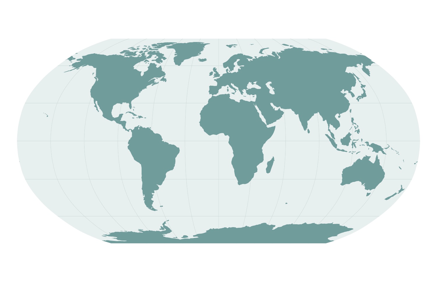
Robinson is a compromise projection. It is neither equal-area nor conformal, but its familiar outline can suit an overview where the overall arrangement of continents matters more than exact area comparisons. Its relatively wide shape can also work well in a landscape layout. PROJ documents its characteristics.
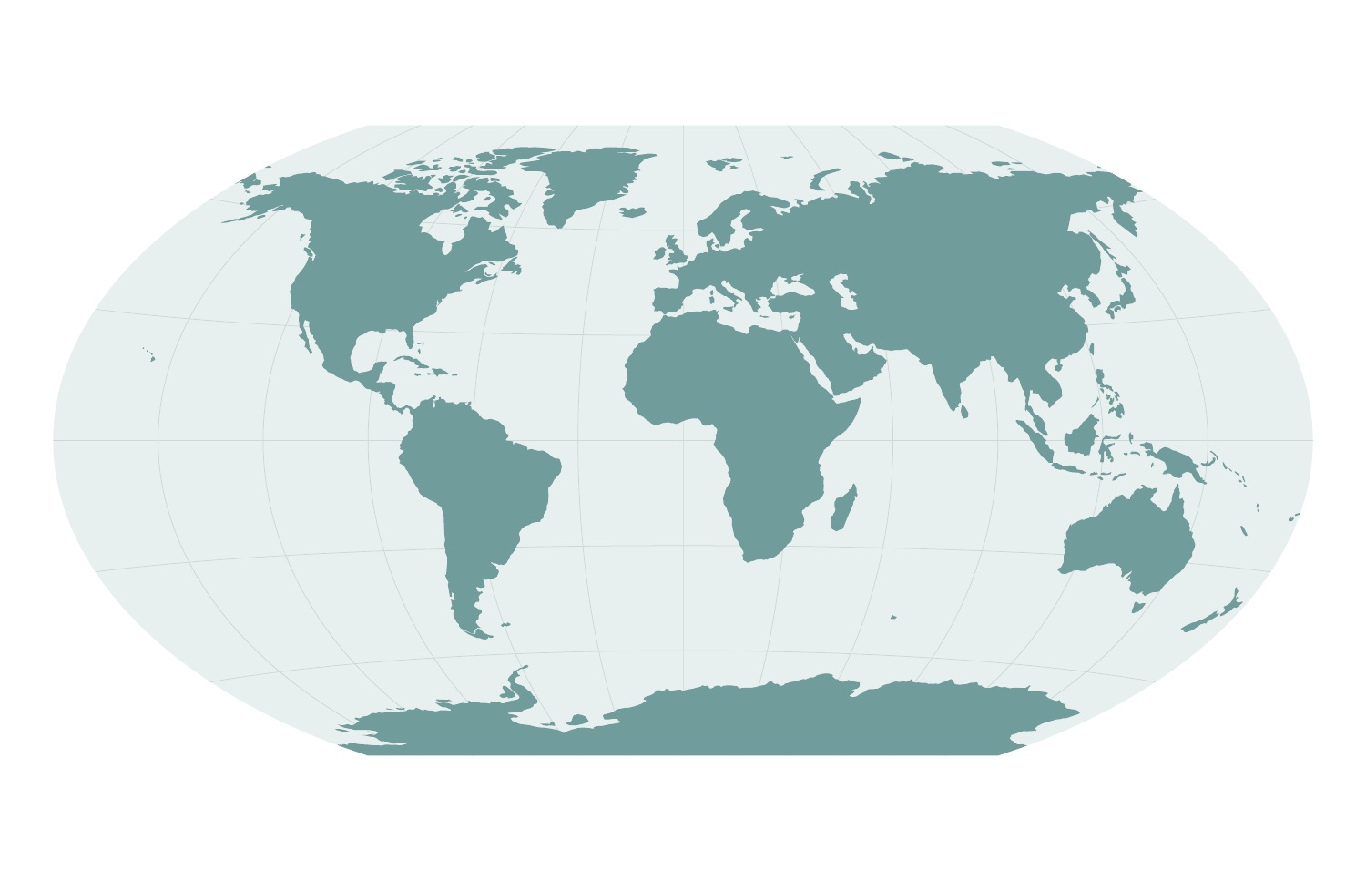
Winkel Tripel balances several kinds of distortion without preserving areas or local angles exactly. It is useful for a general reference world map, but a reader should not use it as an exact visual measure of country areas. Compare its shape with Robinson in the space available in your design. See the PROJ definition.
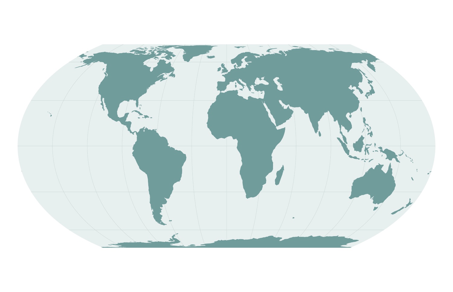
Introduced in 2018 by Bojan Šavrič, Tom Patterson and Bernhard Jenny, Equal Earth is a pseudocylindrical equal-area projection with an outline inspired by Robinson. It combines proportional land areas with a form intended for world maps. It still distorts shapes and does not preserve all distances. The PROJ documentation and the authors’ research paper explain its design.
In September 2026, the UN General Assembly supported the Correct the Map initiative, encouraging equal-area approaches such as Equal Earth where relative geographic size matters, particularly in educational and informational material. This is not a ban on Mercator or a requirement that every UN map use one projection. See the UN’s account of the decision.
Miller Cylindrical is a modified Mercator approach that can include the poles in a rectangular world map. It is neither conformal nor equal-area. Its lower apparent high-latitude enlargement than Mercator should not be mistaken for correct relative areas. PROJ provides the technical definition.
For area comparisons, choose an equal-area map. For an overview, compare the compromises in your final layout. For a country or region, a projection suited to that location may serve better than cropping a world map. Check each product’s specification; this article does not mean every projection is supplied with every download.
Browse the map previews, or ask about a custom map if you need a specific projection. For background artwork in presentations and print, our format guide explains the separate choice between printable and editable files.
Originally written by Hans Van Der Maarel. Substantively revised by the One Stop Map editorial team on 16 October 2026. New comparison figures: Natural Earth (public domain), projected with PROJ. Natural Earth terms.